Apache St
Jump to navigation
Jump to search
This article is a stub. For more information on what defines a stub, see Template:Stub.
You can help 7 Days to Die Wiki by expanding it.
You can help 7 Days to Die Wiki by expanding it.
| Apache St | |
|---|---|
 Looking south along Apache St from the intersection with Arrowhead St and Maple Rd. | |
| Description | |
| Category | Street |
| Game Worlds
| |
| Navezgane | Yes |
Description
Apache St is one of the many streets found in Navezgane. It runs directly from the Southern most point of Navezgane up to the center of the map where it meets up with Arrowhead St and Maple Rd. There is a Church at the northern end between Highway 260 and Maple Rd. Apache St is one of the few roads in the county that runs through multiple biomes and isn't a highway.
Location
The location of Apache St as found in Navezgane
Points of Interest
Church
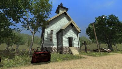
- A Church can be located to the northern end of Apache St not far from the intersection with Arrowhead St and Maple Rd.
- This a good place stop off and look for loot. However, be warned the place is likely to be swarming with Zombies.
Destroyed Town
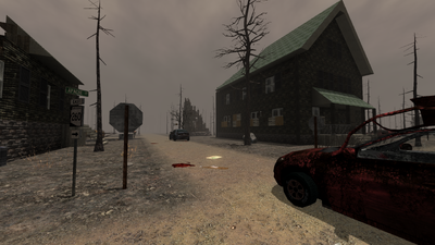
- Destroyed in the forest fire of the Burnt Forest, a town is located at the crossroads of Apache St and Highway 260.
- Approach with caution as there is a strong possibility that you will encounter two or more Zombie Dogs in addition to other Zombies and Hornets.
de:Apache St